Wednesday, July 19, 2023
Longest ride to date
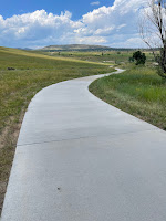
Beautiful 95° Wednesday for my longest bike ride, since I started keeping track. I covered a little over 42 miles, and I think that’s about my personal limit, at my current level of fitness. Here’s my view looking back down the hill, after I started climbing the Bear Creek Dam. Looking forward up the steep hill toward the top of the dam. This climb had me using the lowest possible gearing on my new gravel bike, and I was glad it went that low. Looking over Bear Creek Lake, and toward the town of Morrison and the Red Rocks amphitheater, from the rest area at the top of Bear Creek Dam. It was nice to find some cool shade with a breeze. I wore the special water-retaining gel scarf that Jennefer got for me, and I’m certain that it helped keep my body temperature cooler than it would have been. It was still plenty hot, though. The trail along Highway C-470 has some long straight stretches, and a few non-trivial climbs and descents. There’s also the downside of being next to a highway, with the associated sights, sounds, and smells. But I’m willing to endure it, at least for the few times a year that I get out that way. I was surprised to run into this significant trail closure, and especially disappointed, since the detour would have prevented me from getting to my planned climb up and over the Chatfield Dam from where I was. So I found myself braving the shoulder of the busy highway 121, for the short hop necessary to get to a quieter service road that took me into the park. Made it to the top of Chatfield Dam, and seeking shade under one of the picnic tables in the overlook area. I do enjoy the view of all the various boaters on the lake from here. Heading South on the gravel road on top of the dam, on a quest to intersect the Highline Canal Trail. This kind of rough rock and gravel trail, makes me glad that I opted for a gravel bike. It’s still not all that comfortable to ride on, but the bike is far more controllable. Staying in the narrow ruts is a great goal, as that area has been beaten down smoother by many other riders. Here’s the map of my ride. My route was affected by several trail closures and related detours, all but one of which I already knew about. My Garmin Connect app tells me that I ran out of stamina about 20 minutes before I got home. I’m not in a position to disagree, as I was pretty wiped out. I made use of all the liquids I brought along, finishing off the 16 ounces of Gatorade and 22 ounces of water, over the course of the ride. Maybe some food carbs would help that, on a future long ride.
Subscribe to:
Post Comments (Atom)


No comments:
Post a Comment