
We just got back from a week-long trip to visit with Jennefer's sister Janine and her husband Jerry in Yuma, AZ. We took the southerly route on the way out, and drifted more northerly on the way back. I think my original plan was to make a big loop without retracing our drive, but that idea got lost in the fog of letting Google Maps find our way. We planned for two 8-hour drives each way, for a total of four days and 32 hours of driving. In order to keep ourselves alert and rested for driving, we resolved to change drivers every two hours. We found it easy to forget to switch, so I started setting a reminder on my phone, using a 2-hour countdown timer, and that worked remarkably well. I'm starting to remember that one great benefit of flying myself places, was getting there in less than half the time of driving.
Day 1 - Driving from Littleton to Gallup NM:
 Driving south on I-25, we saw a little snow left on the mountains, north of Trinidad CO.
 The sign says "Trinidad" on top of this interesting mountaintop, west of I-25 in Trinidad CO.

We saw lots of interesting geography on our drive. This starkly rocky hill was just west of Albuquerque.
 Pretty
forest scenery while passing through Flagstaff. I used to have a friend
who lived there. We stopped to visit him, when we drove our car from
San Diego to Littleton back in 1995.
Pretty
forest scenery while passing through Flagstaff. I used to have a friend
who lived there. We stopped to visit him, when we drove our car from
San Diego to Littleton back in 1995.
 Looking
west toward Sedona AZ, after heading south from Flagstaff. I've heard
good things about Sedona, from various friends, including my neighbor
friend whose granddaughter was conceived there, and my other friend, who
flew his home-built Sonex plane from San Diego to Oshkosh, and spent
the night there.
Looking
west toward Sedona AZ, after heading south from Flagstaff. I've heard
good things about Sedona, from various friends, including my neighbor
friend whose granddaughter was conceived there, and my other friend, who
flew his home-built Sonex plane from San Diego to Oshkosh, and spent
the night there.
 I've
been acutely aware of the Continental Divide ever since I first visited
Denver, and went for an exploratory drive up into the Rocky Mountains, and a short hike on the Divide that just about knocked me flat, due to lack of oxygen.
It's a fascinating concept, about the ridge line that defines where
rainfall goes - to the Atlantic or Pacific ocean. As we were driving
west on US-40, just before reaching Gallup NM, I became aware
that there's also a little town named Continental Divide. ;-)
I've
been acutely aware of the Continental Divide ever since I first visited
Denver, and went for an exploratory drive up into the Rocky Mountains, and a short hike on the Divide that just about knocked me flat, due to lack of oxygen.
It's a fascinating concept, about the ridge line that defines where
rainfall goes - to the Atlantic or Pacific ocean. As we were driving
west on US-40, just before reaching Gallup NM, I became aware
that there's also a little town named Continental Divide. ;-)
 Up and at 'em! Enjoying the sunrise and a hotel breakfast in Gallup NM, before heading out for the second day of our driving trip to Yuma. There's a very active railroad line that runs next to highway 66 past our hotel. It's a good thing I love trains!
 I caught this memento photo of the Route 66 highway sign before we left Gallup. My
Dad was such a fan of the history of that road, that on one of his road
trips, he brought us a large chunk of asphalt from Route 66, so we could
also enjoy/treasure the history. (!) (?) We weren't feeling it. But now I
always think of him and his enthusiasm, any time I see, or hear of, that
highway.
I caught this memento photo of the Route 66 highway sign before we left Gallup. My
Dad was such a fan of the history of that road, that on one of his road
trips, he brought us a large chunk of asphalt from Route 66, so we could
also enjoy/treasure the history. (!) (?) We weren't feeling it. But now I
always think of him and his enthusiasm, any time I see, or hear of, that
highway.
 We saw all kinds of different scenery along the way, of course, but I really enjoyed seeing the large expanses of the stereotypical Saguaro desert cactus, after we got into southern Arizona.
  We enjoyed seeing this friendly "Welcome to Yuma!" sign, at an intersection not far from our hotel. It was a cheery reminder of where we were, every morning, as we drove over to visit with Janine and Jerry.
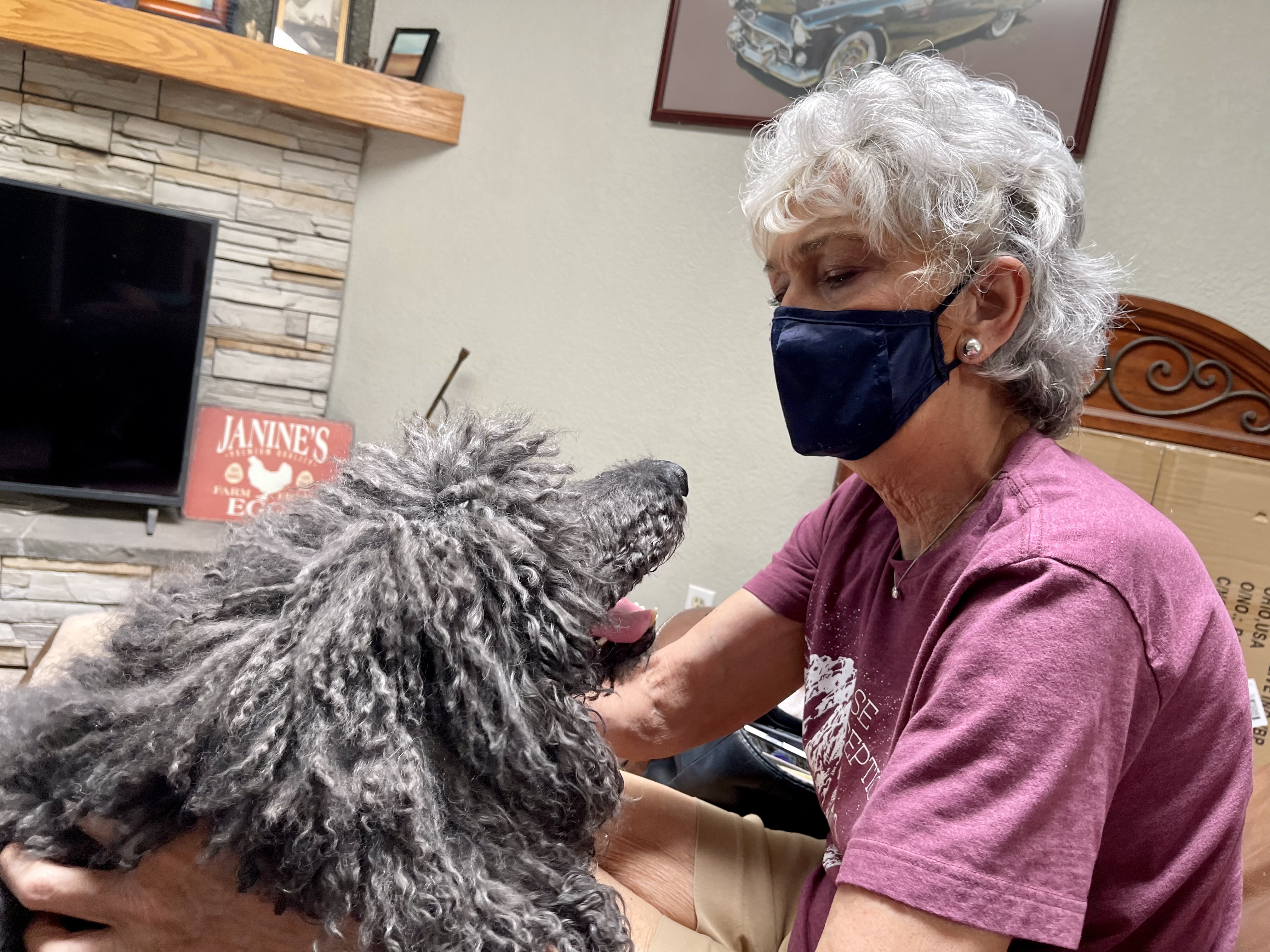
We
visited with Janine and Jerry every day, at their house in Somerton,
just south of Yuma. We had fun watching the Barrett Jackson car auction in West Palm Beach
on TV, with a running commentary by Jerry, the classic car fanatic in the
household. Here's Jennefer giving their poodle Chez some love.

 Mandy
was invited to use their poodle Chez's dog bed, and she pretty much monopolized it for our entire visit. They told us that Chez
doesn't normally use it, because he has difficulty getting into it, with
his back leg problems. Of course, once Mandy started using it, he
started taking another look at his prized possession...
Mandy
was invited to use their poodle Chez's dog bed, and she pretty much monopolized it for our entire visit. They told us that Chez
doesn't normally use it, because he has difficulty getting into it, with
his back leg problems. Of course, once Mandy started using it, he
started taking another look at his prized possession...
Janine has soooo many chickens! They respect the tall fence, most of the time...

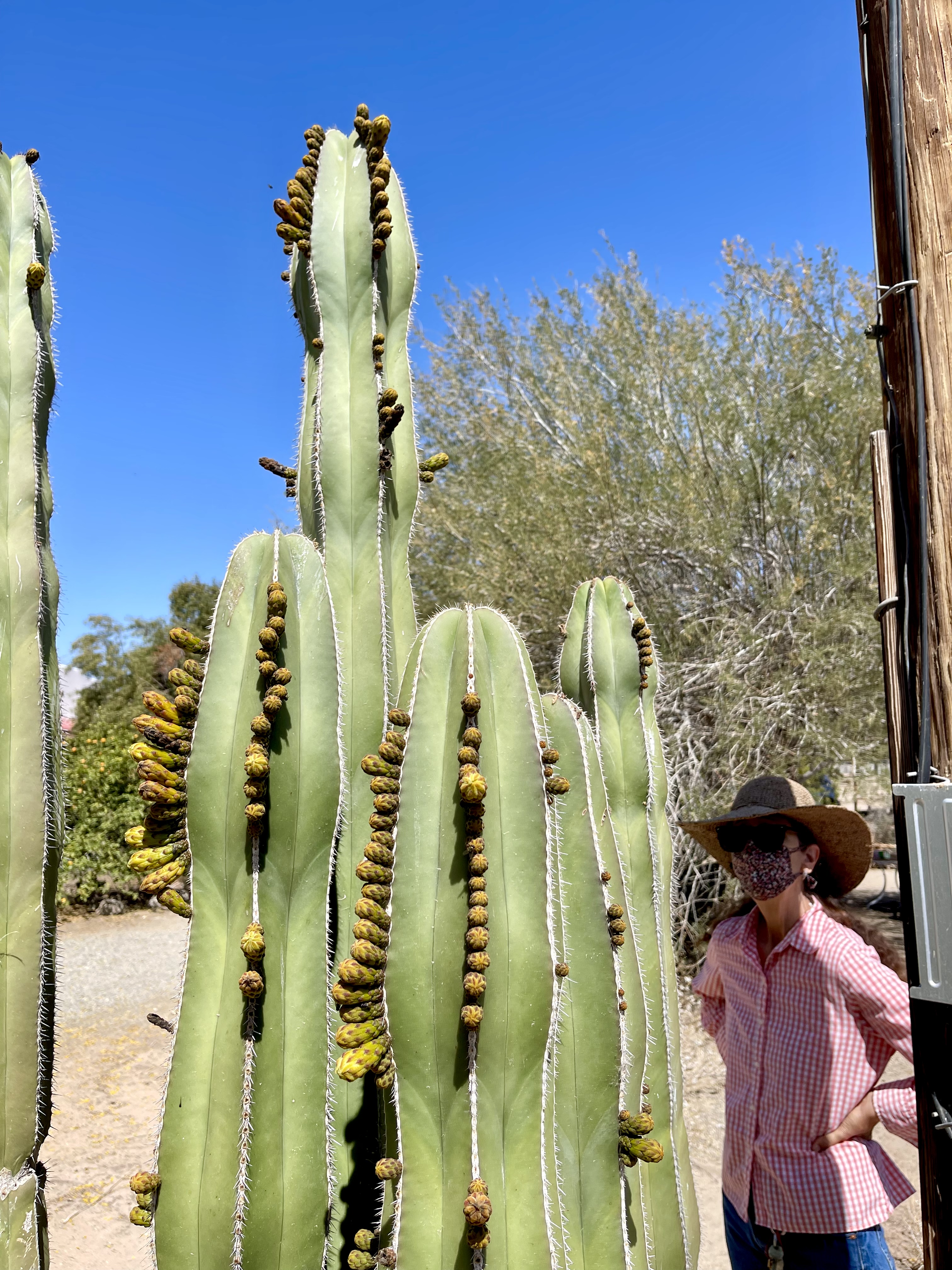 Janine with one of the cacti in her yard. Those things are huge!

Janine picked some of her tangelos for our lunch. They were some of the tastiest tangelos I've had.

Pretty yellow blossoms in Janine's back yard
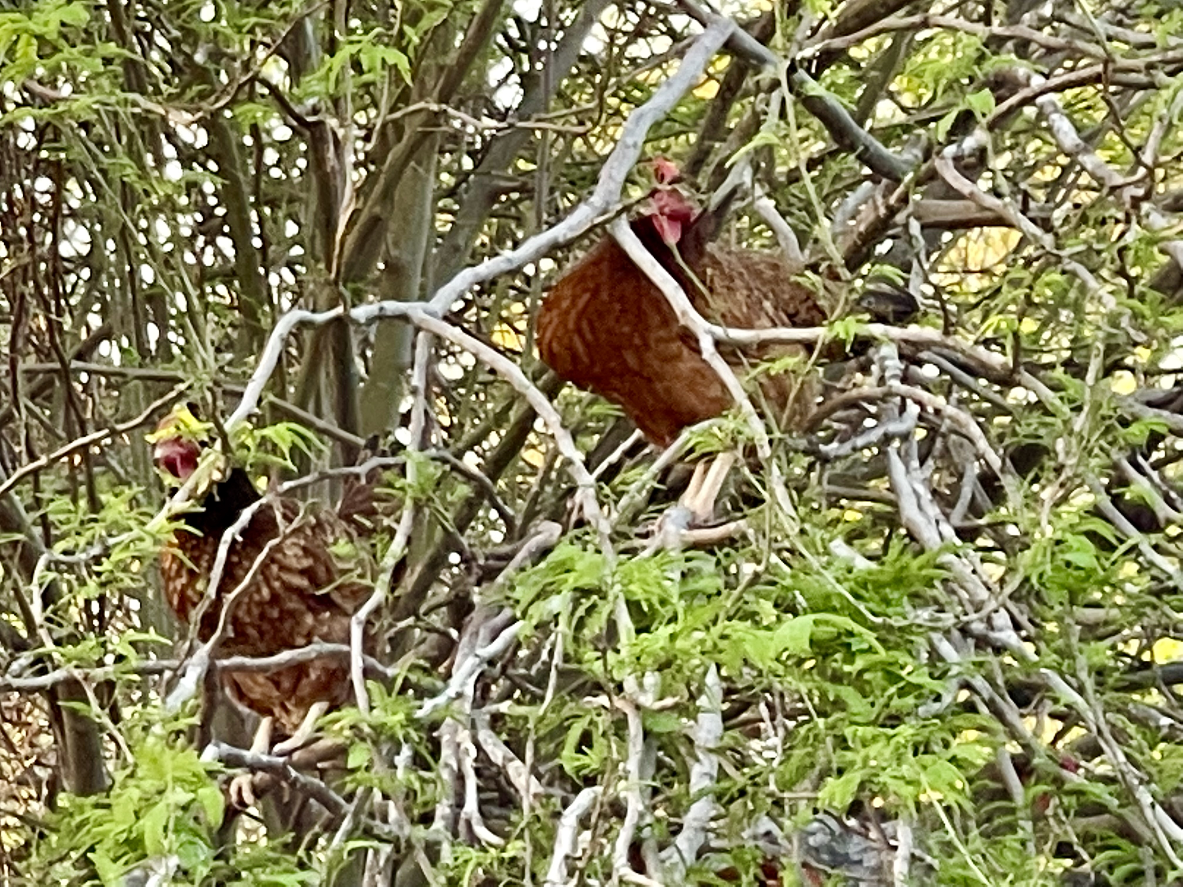 Janine's chickens love roosting in her trees. I guess that's not uncommon, but I was tickled, seeing so many of them up there.

We saw beautiful sunsets every day, while visiting in the Yuma area, usually as we were driving from their house back to our hotel.
 I really liked the evening view of the moon above the nearby palm
trees, while walking Mandy around our hotel. Yuma also has many places where they are growing large areas of date palms, and those gardens provide a
large percentage of the fresh-fruit dates eaten throughout America.
I really liked the evening view of the moon above the nearby palm
trees, while walking Mandy around our hotel. Yuma also has many places where they are growing large areas of date palms, and those gardens provide a
large percentage of the fresh-fruit dates eaten throughout America.

Janine took for us for a walking tour of Yuma's West Wetlands Park, which is right along the Colorado River, and she told us a little about the area's history. She's a knowledgeable and fun tour guide!
 Here's a teepee made from loose fallen branches in the West Wetlands Park.

The Colorado River! This was our first time walking along the Colorado. Its water is highly contested, with the most basic water rights for states defined in 1948. I took this photo from the Charles Flynn Riverfront Trail, while walking through the West Wetlands Park.
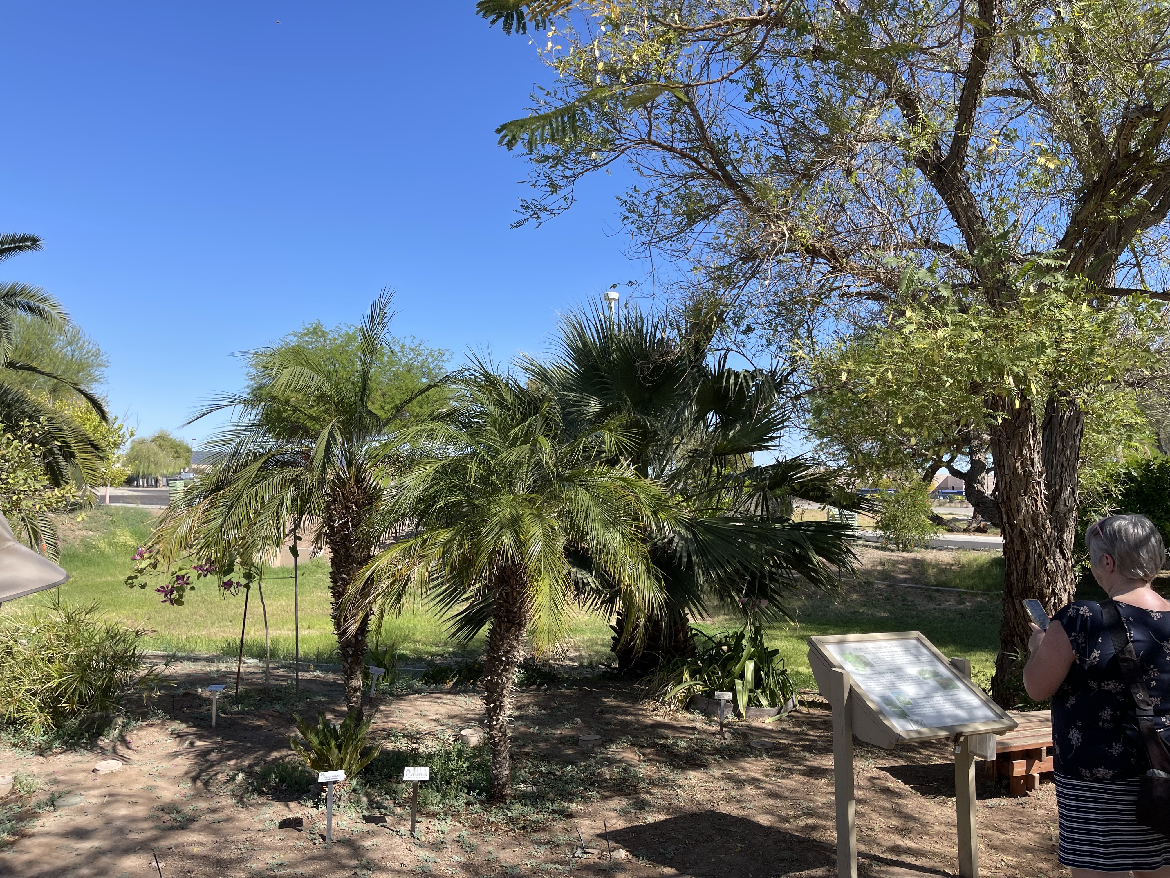
Tour of the University of Arizona's Robert J Moody Demonstration Garden:

Janine casually explained how the garden was established, to the small group of local people who signed up for the tour. Several of the people were there to take advantage of Janine's master gardener knowledge, to help them with their garden issues at home.

They had a nice concrete path leading around the garden.

Hybrid Torch Cactus

Here's a sweet little Moody Garden sign, accented by some beautiful and fragrant roses.

Butterfly and turtle sculptures
Sago and Pygmy Date Palms

Senita Cactus at the Moody Demonstration Garden

"Big Bertha" Trichocereus hybrid

I caught this fun photo of a bumblebee in flight, pollinating a pink cactus blossom.

Golden Barrel cactus

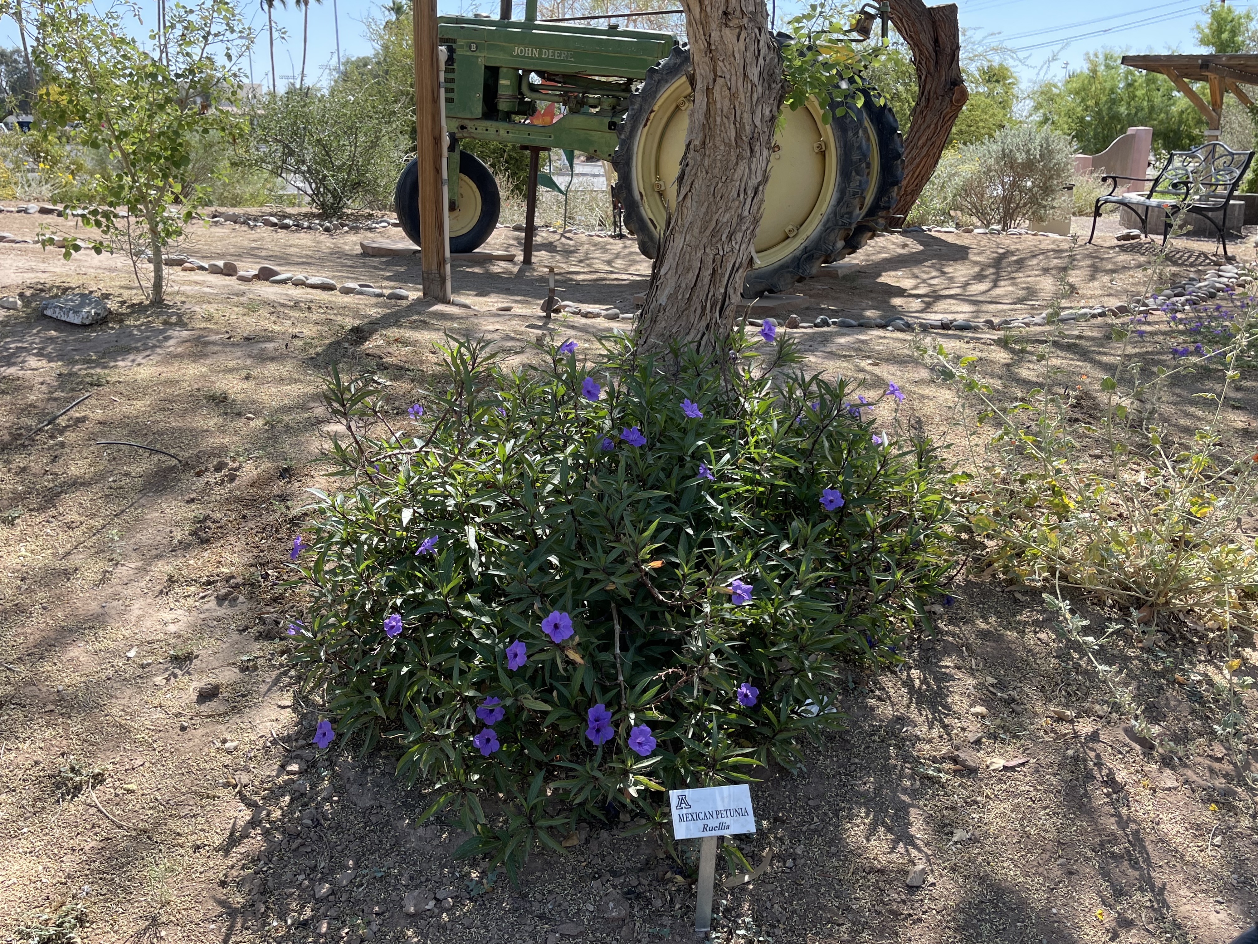
Mexican Petunia

Mandy was wandering pretty close to a spiky Prickly Pear cactus, with pretty yellow blossoms

Prickly Pear cactus blossom

There are lots of different cactus plants in this picture. I neglected to include any informative signs, so I'll go with "Look at all the interesting cacti!"


Cardon Grande Cactus

Pretty red Prickly Pear blossom

Serene little resting area with benches and a tractor

Costa Hummingbird perched in a tree at the garden

Janine had lots of useful desert gardening information to share with the group
 The sign says "Native Plants" - which I guess must mean "Cactus" ;-)

One last look at the pleasant little path around the garden
Day 1 of the return drive - from Yuma to Farmington NM:
This was a windy driving day. It wasn't long after we got through Gallup, that we found ourselves driving through a series of dust storms between Yah-Ta-Hey and Newcomb NM.
 Coming up on the first dust storm.

The second dust storm was worst, where it was blowing through a low spot in the road.

Heading into another low visibility dust storm.
![]() Panorama view of yet another dust storm ahead.
Panorama view of yet another dust storm ahead.
We saw a series of old volcanic plug remnants, along highway US-491 between Gallup and Shiprock NM. The photos are mine, but I grabbed their descriptions from Wikipedia:
 Barber Peak is a 5,778-foot elevation volcanic plug located on Navajo Nation land in San Juan County of northwest New Mexico. It is a prominent landmark set one-half mile east of U.S. Route 491, approximately 15 miles south of the community of Shiprock, New Mexico. Its nearest higher neighbor is Table Mesa, one mile to the west, and Cathedral Cliff is set 1.5 mile to the northwest. Barber Peak is one of the phreatomagmatic diatremes of the Four Corners area, and with significant relief as it rises 300 feet above the high-desert plain. It is situated about 11 miles southeast of Shiprock, the most famous of these diatremes.
 Ford Butte is a 6,156-foot elevation summit located on Navajo Nation land in San Juan County of northwest New Mexico. It is a landmark set one mile east of U.S. Route 491, along with its nearest higher neighbor, Bennett Peak, on the opposite side of the highway. Ford Butte is one of the major diatremes of the Four Corners area, and with significant relief as it rises 450 feet above the high-desert plain. It is situated about 22 miles south-southeast of Shiprock, the most famous of these diatremes.

Bennett Peak is a 6,471-foot elevation summit located on Navajo Nation land in San Juan County of northwest New Mexico. It is a landmark set one mile west of U.S. Route 491, along with Ford Butte on the opposite side of the highway. Bennett Peak is one of the major diatremes of the Four Corners area, and with significant relief as it rises 1,175 feet above the high-desert plain. It is situated about 22 miles south of Shiprock, the most famous of these diatremes.

Table Mesa stood out from a long way, before we got to it. From Wikimedia.org: Northwestern New Mexico's Table Mesa is a moderately large, flat-topped hill bordered by subvertical cliffs and sloping talus piles. Mesas are flat-topped due to the presence of rocks relatively resistant to weathering and erosion. The bedrock at Table Mesa consists of fine-grained to coarse-grained siliciclastics of the Mancos Shale, a moderately widespread, marine unit deposited during the Late Cretaceous. In New Mexico, the Mancos Shale Formation is divided into three parts: 1) lower Mancos Shale - dominated by fine-grained siliciclastics; 2) Gallup Sandstone - a coarse-grained siliciclastic unit; 3) upper Mancos Shale - dominated by fine-grained siliciclastics. Stratigraphy: upper Mancos Shale Formation, Coniacian to Santonian to Campanian Stages, middle Upper Cretaceou. Locality: western side of Rt. 491/Rt. 666, between Newcomb and Shiprock, San Juan County, northwestern New Mexico, USA.
 Cathedral Cliff was just beyond Table Mesa. From Wikipedia: Cathedral Cliff is a 5,810-foot elevation volcanic plug located on Navajo Nation land in San Juan County of northwest New Mexico. It is a prominent landmark set alongside U.S. Route 491, approximately 13 miles south of the community of Shiprock, New Mexico. Cathedral Cliff is one of the phreatomagmatic diatremes of the Four Corners area, and with significant relief as it rises 400 feet above the high-desert plain. It is situated about 9.5 miles southeast of Shiprock, the most famous of these diatremes.
The next thing we knew, we had gone by Ship Rock without seeing it, passed through the town of Shiprock, and were settling down in our room in Farmington. We grabbed a delicious vegetarian dinner from the Pizza-9 next door, and hit the sack.
Day 2 of the drive home - from Farmington NM to Littleton:

It was cold and windy, with some snow-frosted hills nearby, at the rest stop in Del Norte CO. I froze my buns off, walking to and from the Mandy around in the trees, without a jacket on.

Impressive elk sculpture on Lookout Mountain above Del Norte CO.
 Heading east from Saguache toward the Sangre de Cristo mountains.

The Sawatch mountain range, as seen when driving north on US-285 toward Poncha Pass.

Climbing north on US-285 toward Poncha Pass, with the Sawatch Range in the background.

Climbing up to Poncha Pass with the snow-capped Mount Ouray visible off to the left.
 Wind-whipped snow on Mount Ouray, viewed from just after crossing Poncha Pass.

Our accomplished traveler Mandy is cooperatively snoozing in her bed, as we leave the Sawatch Range behind.
 We had a great view of the snow capped TenMile range, as we approached Fairplay. After we passed through Fairplay, things got busier, as we climbed the mountains west of Denver, crossed over Kenosha Pass, and saw a few more cars as we approached Bailey. The next thing we knew, we were back in town, gassing up, and washing and vacuuming the car.


